
There is key to the identification of features in this image. More such images can be found from the the Space Shuttle Imaging home page.
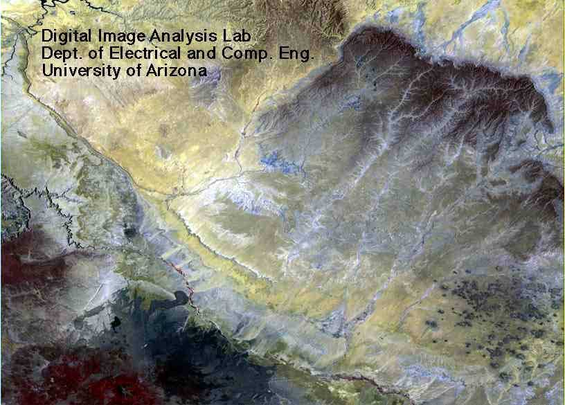
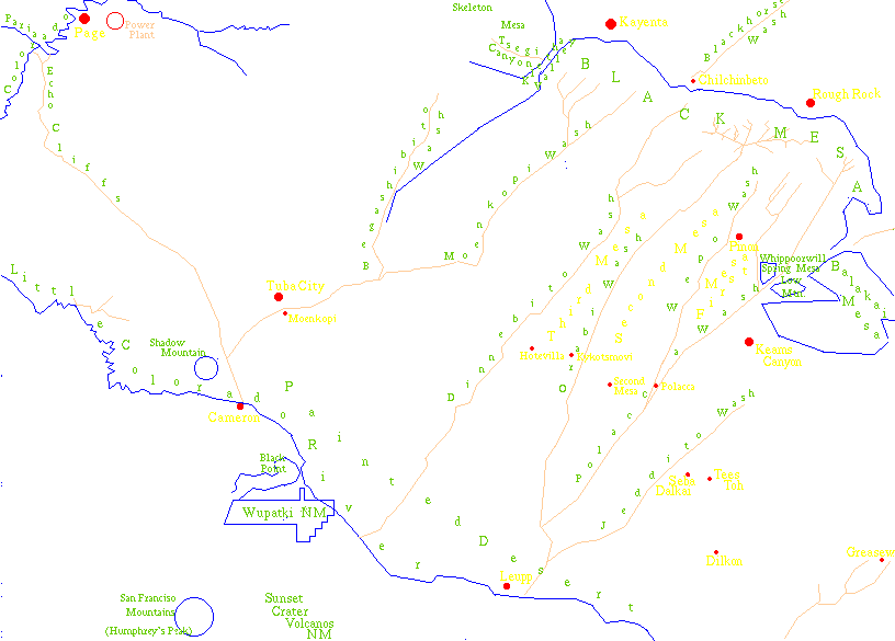
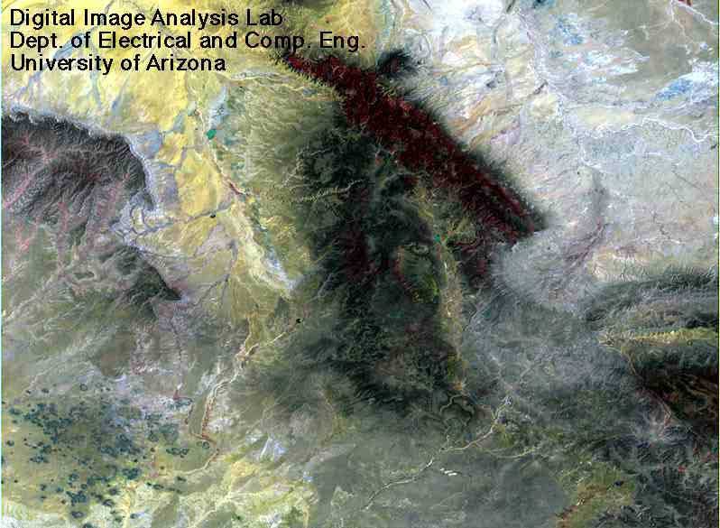
Two Landsat images of this area are available from the Digital Image Analysis Laboratory at the University of Arizona. The first image is of the western part of the Navajo lands and the Hopi lands. An identification chart is provided so that you can find the places mentioned in the text. The second image is of the eastern part of the Navajo lands. An identification chart is also provided for this image. The two images overlap. Use the rim of Black Mesa to orient yourself in the two images.
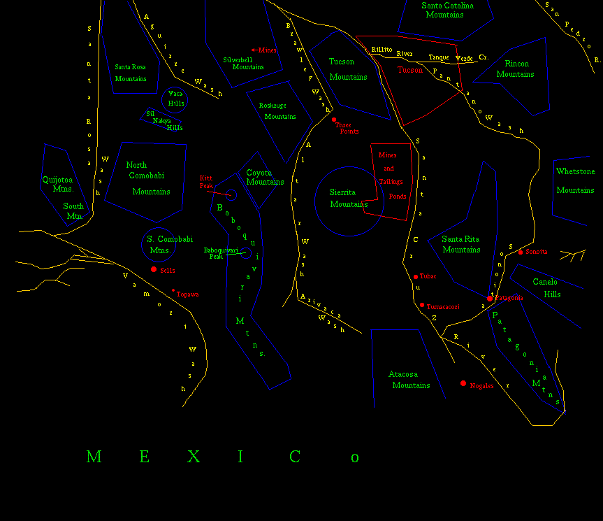
A Landsat image (taken on June 14, 1985) of the region from Tucson westward through the O'odham lands is also available, with a guide to the features seen there.
You may also browse through other Landsat images of the area from a directory provided by the Digital Image Analysis Laboratory at the University of Arizona.
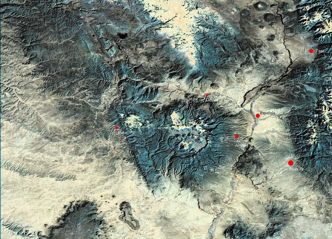
A big (~.5 Meg) and beautiful Landsat image of the Valle Grande region, even farther east in New Mexico, marked with a few town locations is also available.
References
 |
 . .
|


